September 7-14
It’s that time of year again: when four aging knuckleheads — with the youngest among us having just crossed the fifty-year mark (that would be me)— jump on heavily modified dual-sport motorcycles and head into the unforgiving vastness of the American West, where a single mistake can end a trip early, yet some of life’s best memories are created, and some of those memories turn into full-sleeve tattoos. Ask me how I know….
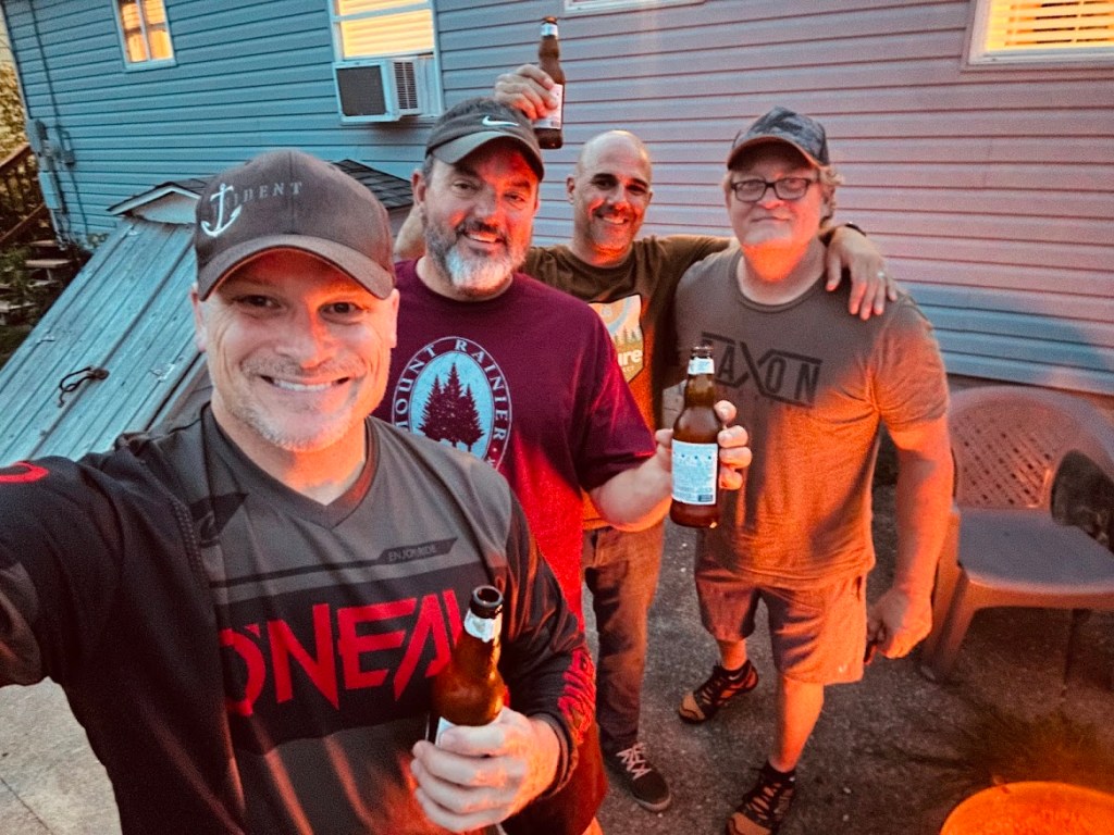
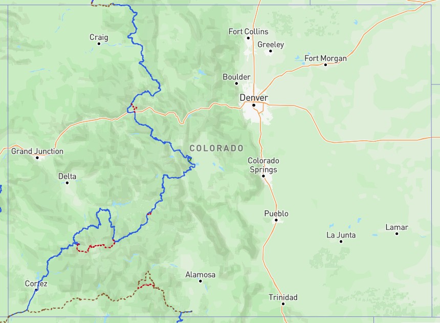
Over the course of this journey, we’ll tackle roughly 800 miles of rugged Rocky Mountain single-track trails, water crossings, steep ascents and brake-smoking descents, and whatever else the backcountry decides to throw our way. Temperatures are expected to range from the high 30s to the low 80s depending on elevation. Today, we discovered that a portion of the route is currently under mandatory evacuation due to wildfires tearing across parts of the countryside. Fortunately, we’re still a couple of months out, so hopefully fire conditions won’t become an issue. We’ll no doubt see the destruction left behind.
There is something uniquely special about the established Backcountry Discovery Routes scattered across the western United States. These routes weave through some of the most hostile, remote, desolate, and breathtaking terrain in North America. The Colorado Backcountry Discovery Route (COBDR) may not be the longest of all the BDRs, but it will undoubtedly challenge us both physically and mentally. For months, we’ve been studying maps, working on our bikes, reviewing historical weather patterns for the areas we’ll be riding through, and preparing for the unexpected.
Route Maps
Route Website
Colorado Backcountry Discovery Route (COBDR) Map & Information
COBDR Vid
This year, the blog will be a little different. I do not plan to write end-of-day trip reports like I’ve done on previous adventures. Quite frankly, it takes too much time, especially when typing on a phone with two thumbs while simultaneously trying to conserve battery life. I may post the occasional Facebook photo, but the plan is simple: take plenty of pictures throughout the trip, jot down brief daily notes, and then turn the entire experience into a more entertaining story once the ride is complete.
Between the four of us, we’ll be carrying four GoPros, a 360-degree camera, four dedicated navigation units, and, of course, four phones in case we need backup navigation. I’ll be carrying the Garmin InReach satellite communicator. While newer iPhones now have built-in satellite communication capabilities, the Garmin has a dedicated SOS feature that can send emergency assistance if things go sideways. I mean – who doesn’t want a helicopter ride 😊? It also allows me to pull weather reports directly from the device, which can be critical for last-minute decision-making when cell service disappears. We all run voice-activated Cardo helmet communication systems as well, allowing us to stay connected while riding and making long days on the trail far more enjoyable.
Truth be told, these trips are far from cheap.
Every bike requires extensive modifications: luggage systems, extra fuel bottles, spare tubes, trail tools, suspension upgrades, protective armor, electronics, fresh tires, oversized fuel tanks, mounted water bottles, crash bars, transportation logistics to and from the route, and countless other expenses. Then there’s the riding gear itself — helmets, jackets and pants with integrated armor, adventure boots, warm-weather gloves, cold-weather gloves, rain gear, and all the other equipment necessary to strike that perfect balance between comfort and functionality without adding too much weight for the suspension to manage.
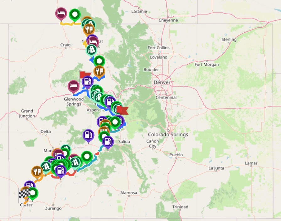
Every time we tackle one of these major trips, one of us takes the lead roughly ten months in advance and starts organizing the entire adventure. Last year, I planned our Michigan Upper Peninsula ride. This year, Jeff has taken point and built the entire trip using Microsoft OneNote. We already know exactly where we’ll be staying each night, which restaurants we’ll be eating at, which gas stations we’ll stop at, and every point of interest along the route.
Jeff has meticulously programmed every imaginable detail into our GPX tracks, giving us precise daily mileage, distance to destination while in motion, fuel range calculations, daily riding distances, and numerous other data points designed to make the trip run as smoothly as possible.
By the time this is over, we’re going to sweat, probably smell terrible, look borderline homeless, experience an unscheduled dismount or two, collect a few bruises, and most likely deal with a flat tire somewhere along the way. We’re prepared for all.
But this is what the four of us are enthusiastic about – so let’s ride.
In fact, we’re already casually throwing around ideas for rides over the next two to three years, including overseas adventures in Iceland or Vietnam, or possibly tackling sections of the Trans-Euro Trail (TET) throughout Europe or even another BDR. Each offers similar, well-established adventure and dual-sport multi-week trail systems that continue to feed our sickness for this kind of hobby.
Below is an example of the daily tank-bag notes Jeff created for each riding day.
Note: The official route was designed from south to north, but we’re starting in Baggs, Wyoming, and riding southbound toward Four Corners.
Example Daily Route Notes
Day 1
Total Mileage: 109 Miles
Route: Baggs, Wyoming to Steamboat Springs, Colorado
Breakfast: Cowboy Inn
Lunch: Clark Store (75 miles from start)
Dinner: Aurum Steamboat
Route Notes:
A relatively easy introduction to the BDR. Mostly flat roads cutting through farmland with great scenery. Conditions can become extremely slick if roads are wet. Local crews use chloride treatments to reduce dust, so wet surfaces may contain chemical residue.
Fuel Plan:
Fill up in Baggs. Fuel range will comfortably cover the entire section. Top off fuel bottles.
Lodging:
Homewood Suites – Two queen beds with pull-out couches.
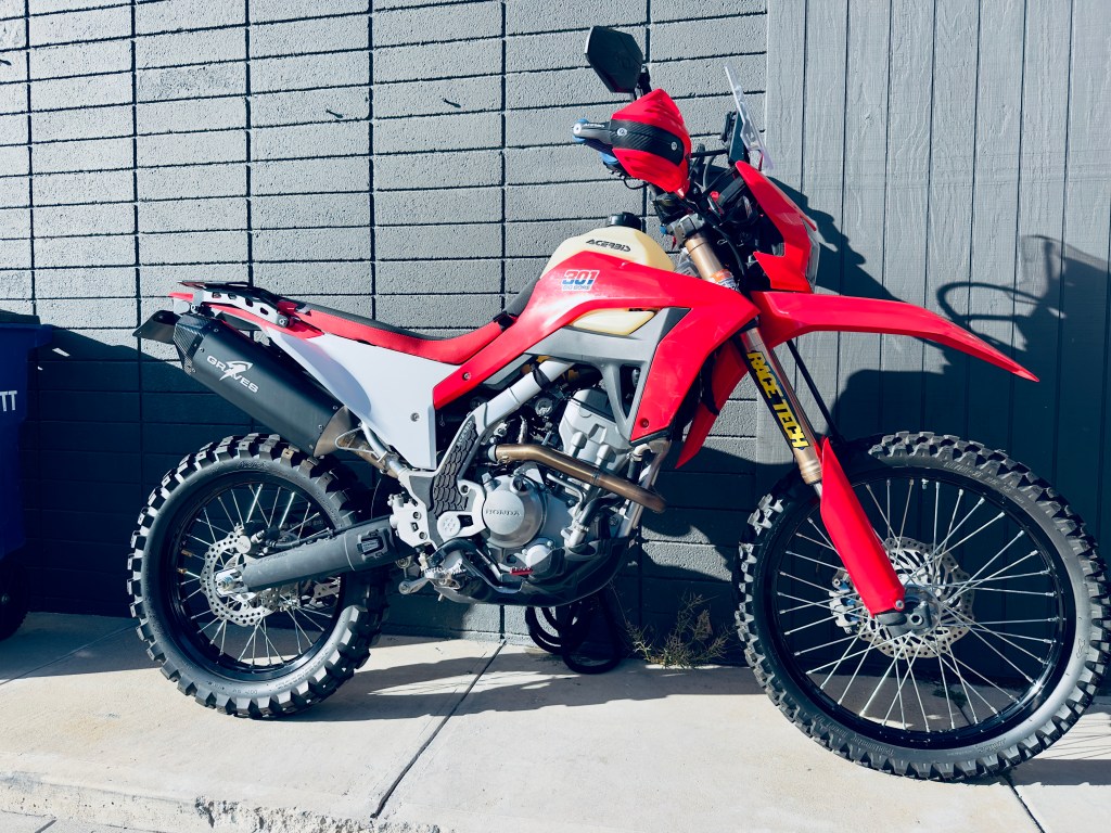
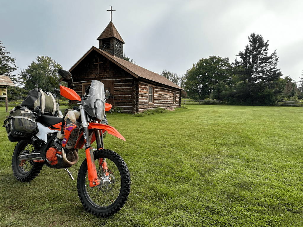
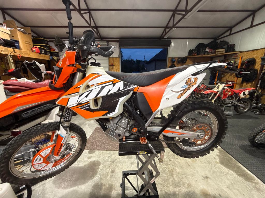
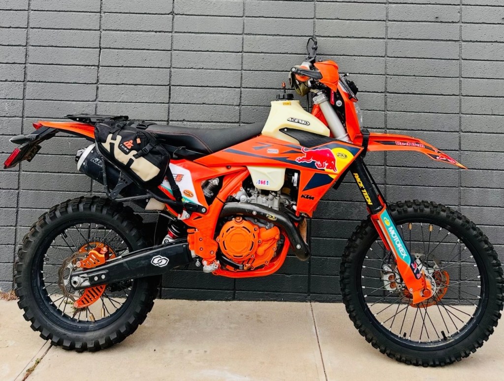
The Bikes. A Honda and 3 KTMs – The Honda has a big bore kit, and the 3 KTMs are street legal race bikes – this should be fun!
Daily Route Breakdown
Trip Start Date: September 7th
Day 1: Baggs, Wyoming → Steamboat Springs, Colorado
Day 2: Steamboat Springs → Gypsum, Colorado
Day 3: Gypsum → Buena Vista, Colorado
Day 4: Buena Vista → Lake City, Colorado
Day 5: Lake City → Telluride, Colorado
Day 6: Telluride → Four Corners Monument
The only location in the United States where four states — Colorado, New Mexico, Arizona, and Utah — intersect.
Day 7: Four Corners → Home
Adventure riding is a strange addiction, but it fits our personalities.
Thousands of dollars are spent preparing machines that are intentionally taken into some of the harshest terrain imaginable, far from the local bike or tire shops, where comfort is limited, and mistakes can have serious consequences.
Yet somehow, year after year, we keep coming back for more.
And honestly… we wouldn’t have it any other way.
…..Kevin, Matt, Jeff, Ron….
 Adventure Motorcycle Blog
Leave a comment